About PrettyMap - World Atlas and Maps, GPS
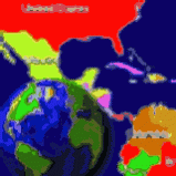
View maps of Earth and other planets with PrettyMap! See current day and night regions, learn geography by taking the quiz, enjoy 3D elevation surfaces, measure distances between locations and create your own maps with...
View maps of Earth and other planets with PrettyMap! See current day and night regions, learn geography by taking the quiz, enjoy 3D elevation surfaces, measure distances between locations and create your own maps with special places! PrettyMap lets you view vector and raster maps and images (such as country boundaries, world cities, rivers, satellite photos), search in geographically-referenced data, visualize and analyze spatial information, download current weather reports and forecasts, extend your knowledge by taking an educational quiz, and edit your own simple maps. PrettyMap is a GIS program with the following features:
- support for vector maps (points, lines, areas)
- support for raster maps (terrain elevation and bathymetry, images, symbolic)
- displays maps of various planets
- supports GPS, logging GPS locations, wardriving and the "follow GPS" mode
- GPS fleet tracking service: PrettyMap can regularly report locations so that you know where your fleet is, and others know where you are
- displays current weather maps, detailed weather reports and forecasts (requires Internet connection)
- all maps are free:
- political: country boundaries with country names, capitals, population sizes, ...
- comprehensive set of data for each country, based on the current information from The World Factbook
- elevation data for Earth, Moon, Mars
- lunar mountains, craters and crater chains, seas, lakes, swamps, valleys, ...
- spherical projection
- relief and 3D elevation (DEM) view with vector map overlay
- shows day and night regions, shadow length and sun/north orientation
- zoom range from whole planet to meters
- multiple, configurable vector map layers
- data search for vector map databases
- versatile quiz with teacher mode
- bar charts and color-by option
- distance measurement
- integrated user-defined locations (Points Of Interest) editor, stores notes and values for each POI
- sessions to quickly save/restore program state
Previous Versions
Here you can find the changelog of PrettyMap - World Atlas and Maps, GPS since it was posted on our website on 2015-04-26 03:00:00.
The latest version is 5.5 and it was updated on 2024-04-23 00:04:58. See below the changes in each version.
PrettyMap - World Atlas and Maps, GPS version 5.5
Updated At: 2008-11-24
Disclaimer
External Download
We do not host PrettyMap - World Atlas and Maps, GPS on our servers. We did not scan it for viruses, adware, spyware or other type of malware. This app is hosted by the software publisher and passed their terms and conditions to be listed there. We recommend caution when installing it.
The external download link for PrettyMap - World Atlas and Maps, GPS is provided to you by apps112.com without any warranties, representations or guarantees of any kind, so access it at your own risk.
If you have questions regarding this particular app contact the publisher directly. For questions about the functionalities of apps112.com contact us.